Below are links to the City's Geographic Information System (GIS) data, tools & maps.
Users can visualize, select, and explore zoning, wetland, flood elevation and oceanfront overlay information for Cannon Beach.
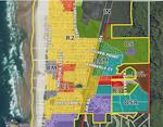
The interactive GIS mapping tool combines county and city databases with geographic areas and features. The application also links to ORMAP, State of Oregon mapping which provides access to 100% of the county taxlot maps as well as supplementary information from Clatsop County.