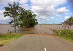
Cannon Beach is at risk of flooding from two primary sources: riverine flooding and Ocean flooding. Riverine flooding generally occurs during periods of heavy rainfall that cause the streams that drain the hills east of Cannon Beach to overflow their banks. Ocean flooding results from exceptionally high tides or tsunamis. On some occasions, high tides and riverine flooding can combine to produce flooding in the City.
An additional flooding hazard that impacts the safety and the well being of Cannon Beach residents is the annual riverine flooding of Highway 101 between the south limits of the City of Seaside and the junction of Highways 26 and 101. During periods of heavy rainfall each winter season, the roadway becomes impassable by floodwater from the Necanicum River, often closing the road to passenger vehicles. While the flooding causes little damage to structures, it interrupts commerce along the only North-South roadway on the Oregon Coast and the major transportation route between the North Oregon Coast and the Portland-Vancouver metro area on the Interstate 5 corridor. It also isolates The City of Cannon Beach from Clatsop County's two hospitals, and impairs ambulance, police, and fire services.
The City's Flood Insurance Rate Map highlights the location of the flood hazard in Cannon Beach. The City's current effective date for the Flood Insurance Rate Maps is September 17, 2012.
The Clatsop County Multi-Jurisdictional Natural Hazard Mitigation Plan adequately identifies the previous occurrences of floods for the City of Cannon Beach. The Clatsop County Multi-Jurisdictional Natural Hazard Mitigation Plan ranked the vulnerability of floods as moderate. The County Plan also indicates that the probability of floods is high. These scores would be representative of Cannon Beachs risk as well.
The City of Cannon Beach is a participant in the National Flood Insurance Program. The City has a total of 487 policies under the NFIP, 124 of which are located in A zones. The total coverage for the City under the NFIP is $120,819,700. There have been 13 claims since 1978, with $157,247 paid on those claims. As of June 2008, there has been one repetitive loss property in the City of Cannon Beach.
The number and types of structures located in the floodplain are not available at this time.
Absent a tsunami, Cannon Beach has had a low incidence of serious flooding since a dike was constructed along the banks of Ecola Creek in the immediate vicinity of the main commercial areas in the 1960s. Prior to dike construction, the business district in Cannon Beach became flooded routinely during periods of heavy rainfall. Mitigation measures for the Cannon Beach business district should be focused on assessing and maintaining the integrity of the Ecola Creek diking structures. Mitigation measures for the routine flooding of Highway 101 should continue.
